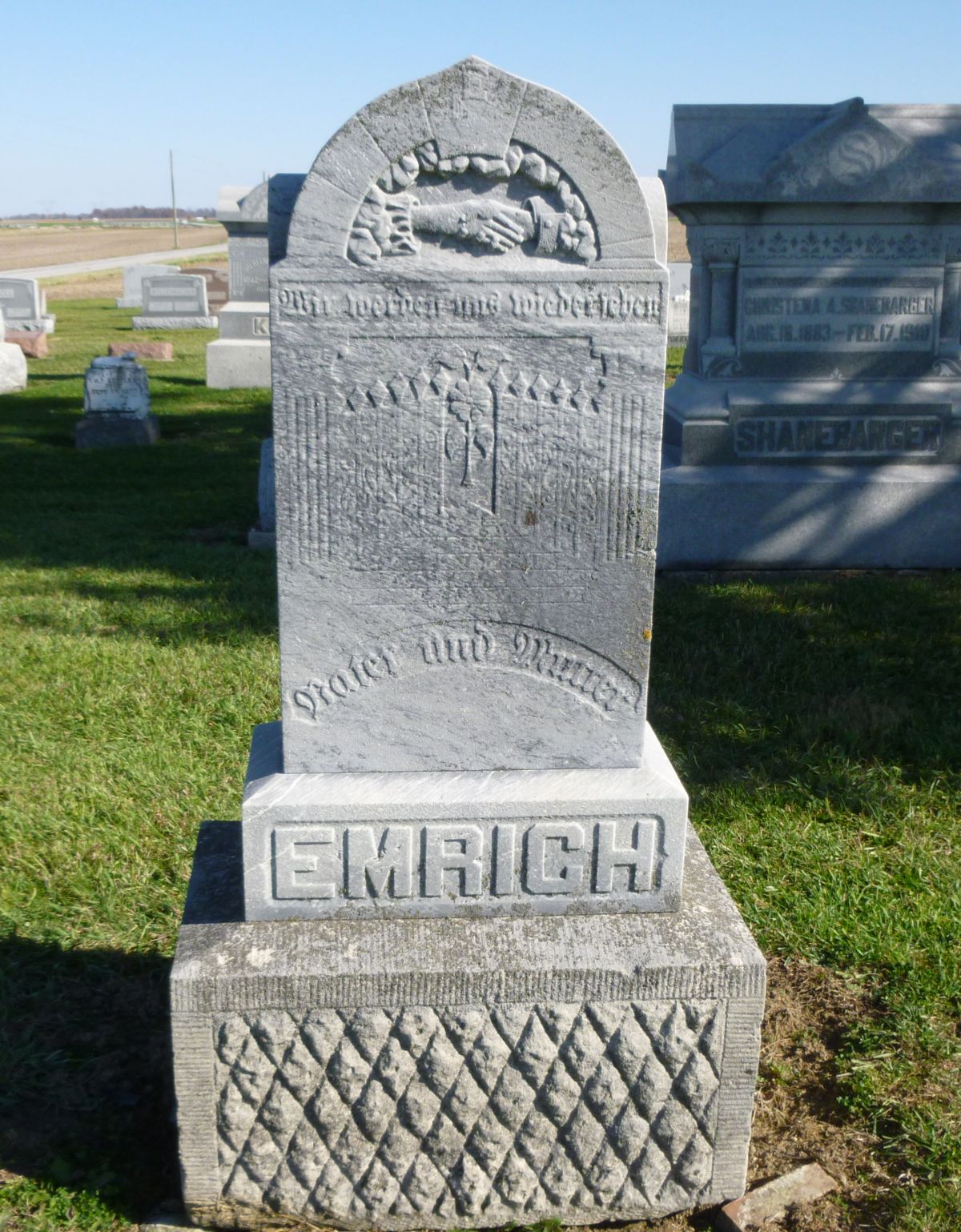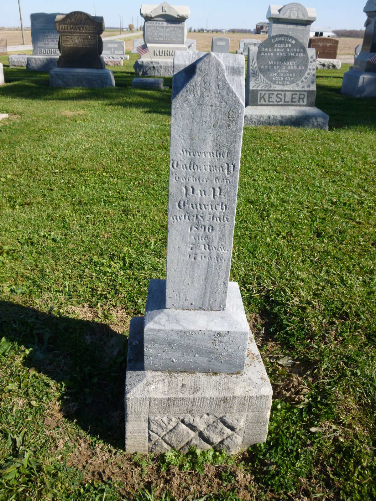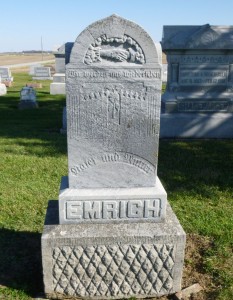
Philipp & Margetha Emrich, Kessler/Liberty Cemetery, Mercer County, Ohio. (2014 photo by Karen)
This is the tombstone of Philipp and Margetha Emrich, located row 8 of Kessler/Liberty Cemetery, Mercer County, Ohio. The marker is inscribed Emrich on the front. On the south side:
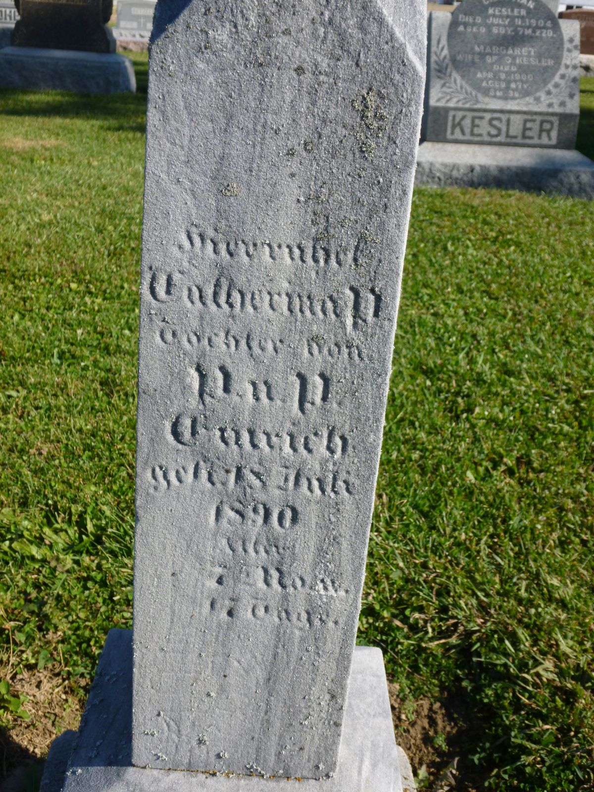
Hier ruhet in ?
Philipp
Emrich
Geb. Den 26,
Aug 1821
Gest. Den 4,
Dez. 1891
Alter
70 J, 3 M, 8 T
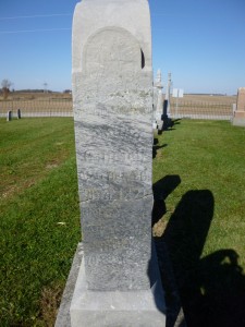
On the north side:
Hier ruhet in ?
Margetha
Emrich
Geb. Den 5,
Dez. 1828
Gest. Den 5,
Marz 1906
Alter
77 J, 3 M
Translation: Here rests in ? Philipp Emrich, born on 26 Aug 1821, died 4 Dec 1891, age 70 years, 3 months, 8 days. Here rests in ? Margetha Emrich, born on 5 Dec 1828, died 5 March 1906, age 77 years, 3 months.
Inscribed on the front of the stone: Wir Werden und Weidersehen—“And we will see each other again.” Vater und Mutter–“Father and Mother”
It is very helpful, but unusual, when tombstones of this era are inscribed with the birth date as well as the death date. Especially helpful since this couple was born in the early 19th century and I know very little about them. They left only one record in Zion Chatt’s records—Margetha’s death and burial record. I do not know her maiden name. Evidently they married in Bavaria and their two children were born there.
In 1870 Philipp and Margetha “Margret” Emrich were living in Montgomery County, Ohio, with a Vandalia post office. Living with them were their two children, Philip, 18, and Maggie, 16. All were born in Bavaria. Philipp Sr. gave his age as 49 and Margret’s as 43. Philipp had a personal estate was worth $500 but did not own real estate. [1]
The couple and their children moved to Mercer County sometime between 1870 and 1880, but most likely after 1873 when their daughter was married in Montgomery County.
In 1880 Phillipp and Margret were living in Liberty Township with their son Philip. Phillipp Sr was 58 years old, Margaret 52, and Phillip Jr 30. All were born in Bavaria. Phillipp Sr was a farmer and Phillip Jr helped on the farm. [2]
Philipp died in 1891 and Margret remained on the family farm south of Chatt.
Philipp Emrich inscription, south side of ston. (2014 photo by Karen)
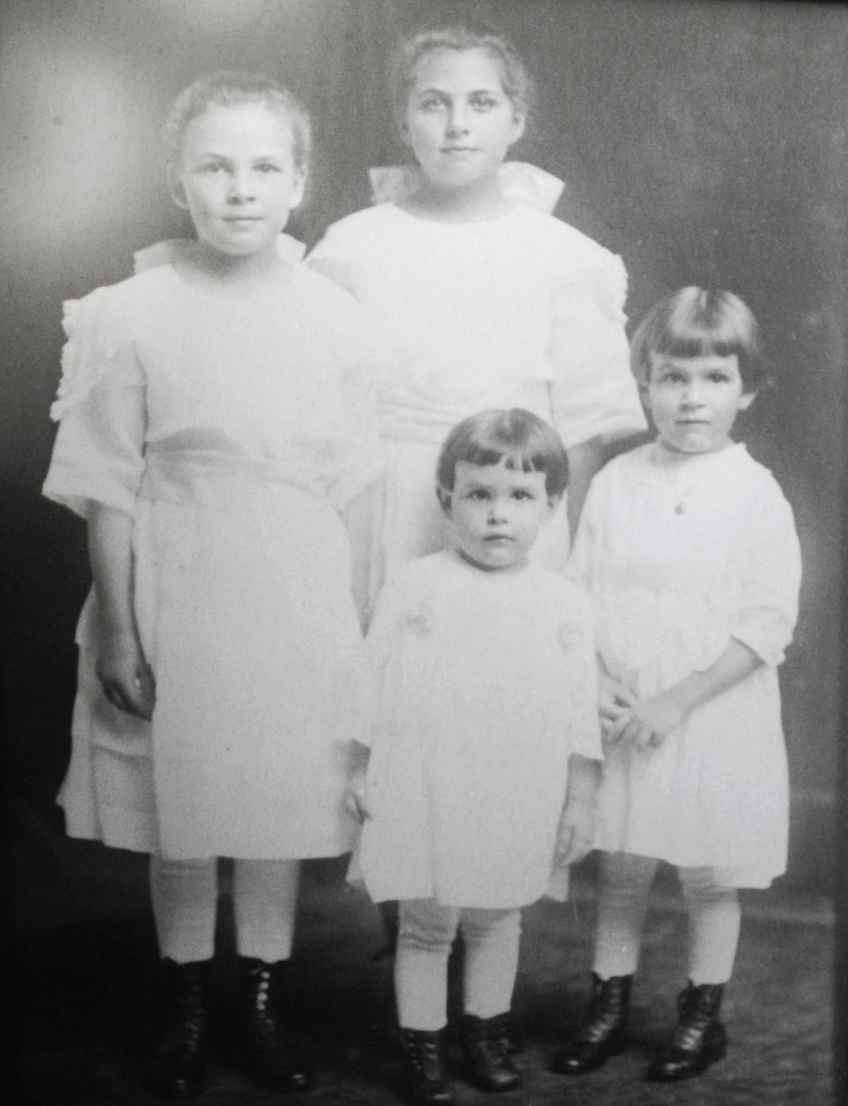
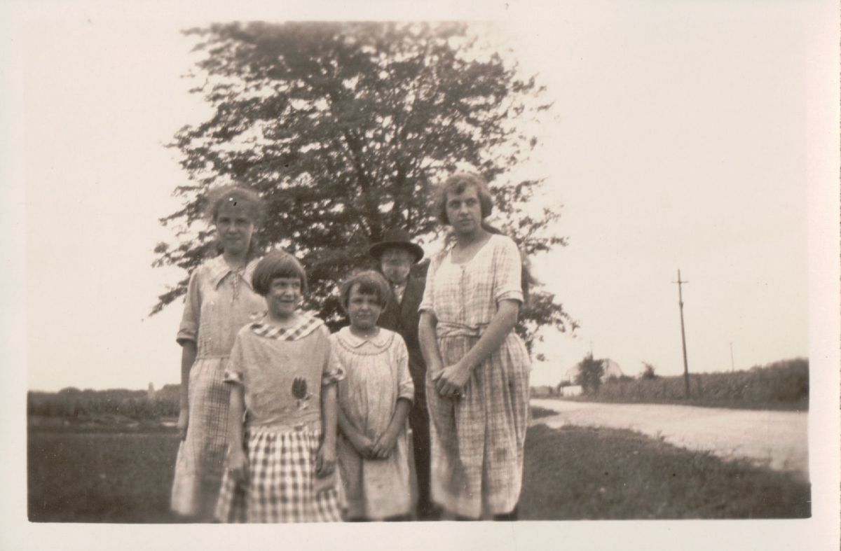
In 1900 Margret’s granddaughter Sena was living with her, probably helping with the housework and helping care for her aging grandmother. Margret, a widow, was 74 years old. She had given birth to two children and neither were living in 1900. Margret was born in Germany and immigrated in 1865. She owned her farm. Her granddaughter was 15 years old, born in Ohio in July 1884. [3]
Margret Emrich died 5 March 1906 in Liberty Township. Margret’s probate death record is on the same page as that of her son Philip. The cause of her death was not given in this record. [4] However, her death and burial are mentioned in Zion Chatt’s records. That record indicates that she died 5 March 1906 at the age of 78 years and 2 months. She was buried on the 6th. Survivors included 2 sisters, 14 grandchildren, and 5 great-grandchildren. It also indicates that she was found dead in a well.
Philipp and Margret had two children, a son and a daughter, who were both born in Germany. Their daughter Margarethe “Maggie” (c1855-bef 1900) married Philipp Wendel on 11 February 1873 in Montgomery County, Ohio. [5] Their son Philip (1849-1896) married Philipina Fickert on 11 November 1884 in Louisville, Kentucky. [6]
[1] 1870 U.S. Census, Wayne, Montgomery County, Ohio, p.814B, family 135, dwelling 145, Philip Emerick; FamilySearch (www.familysearch.org : accessed 22 Nov 2014), from FHL microfilm 552747, from NARA microfilm M593, roll 1248.
[2] 1880 U.S. Census, Liberty Township, Mercer County, Ohio, ED 186, p.474C, dwelling 56, family 59, Phillip Emerick; FamilySearch (www.familysearch.org : accessed 22 Nov 2014), from FHL microfilm 1255048,from NARA microfilm T9, roll 1048.
[3] 1900 U.S. Census, Liberty Township, Mercer County, Ohio, ED85, p.9A, dwelling 168, family 173, Margret Emrich; FamilySearch (www.familysearch.org : accessed 22 Nov 2014), from FHL microfilm 1241304, NARA microfilm T623, roll 1304.
[4] ”Ohio, County Death Records, 1840-2001,” index and images, FamilySearch (www.familysearch.org : accessed 22 Nov 2014), from Mercer County Probate Deaths, Vol 1-2, 1867-1908, unpaginated.
[5] “Ohio, County Marriages, 1789-1997,” index and images, FamilySearch (www.familysearch.org : accessed 22 Nov 2014), Philip Wendel and Margareth Emerick, 11 Feb 1873; FamilySearch (www.familysearch.org : accessed 22 Nov 2014), citing Montgomery, County, Ohio Marriages Vol. K, 1872-74, p. 264, from FHL microfilm 1030838.
[6] “Kentucky Marriages, 1785-1979,” index, FamilySearch (www.familysearch.org : accessed 1 November 2014), Philip Emrich and Philaphina Fickert, 11 November 1884; from FHL microfilm 588892.