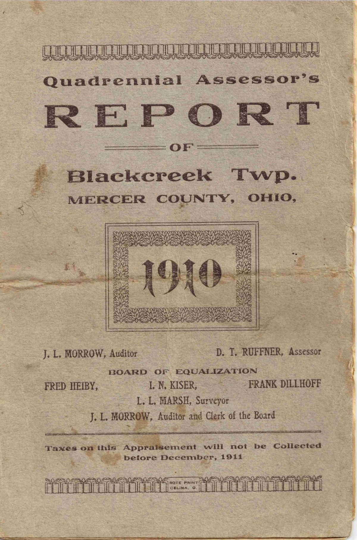
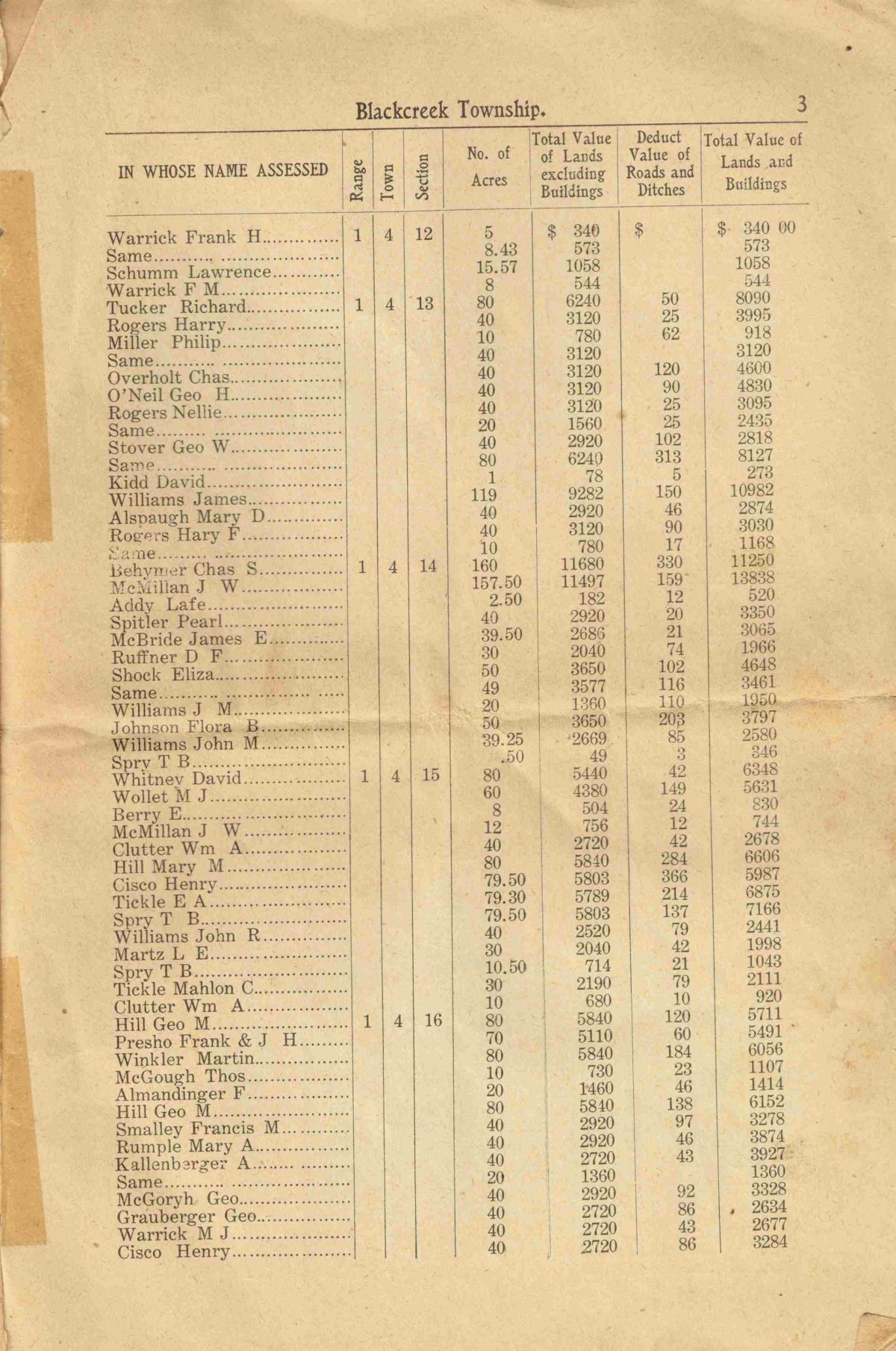
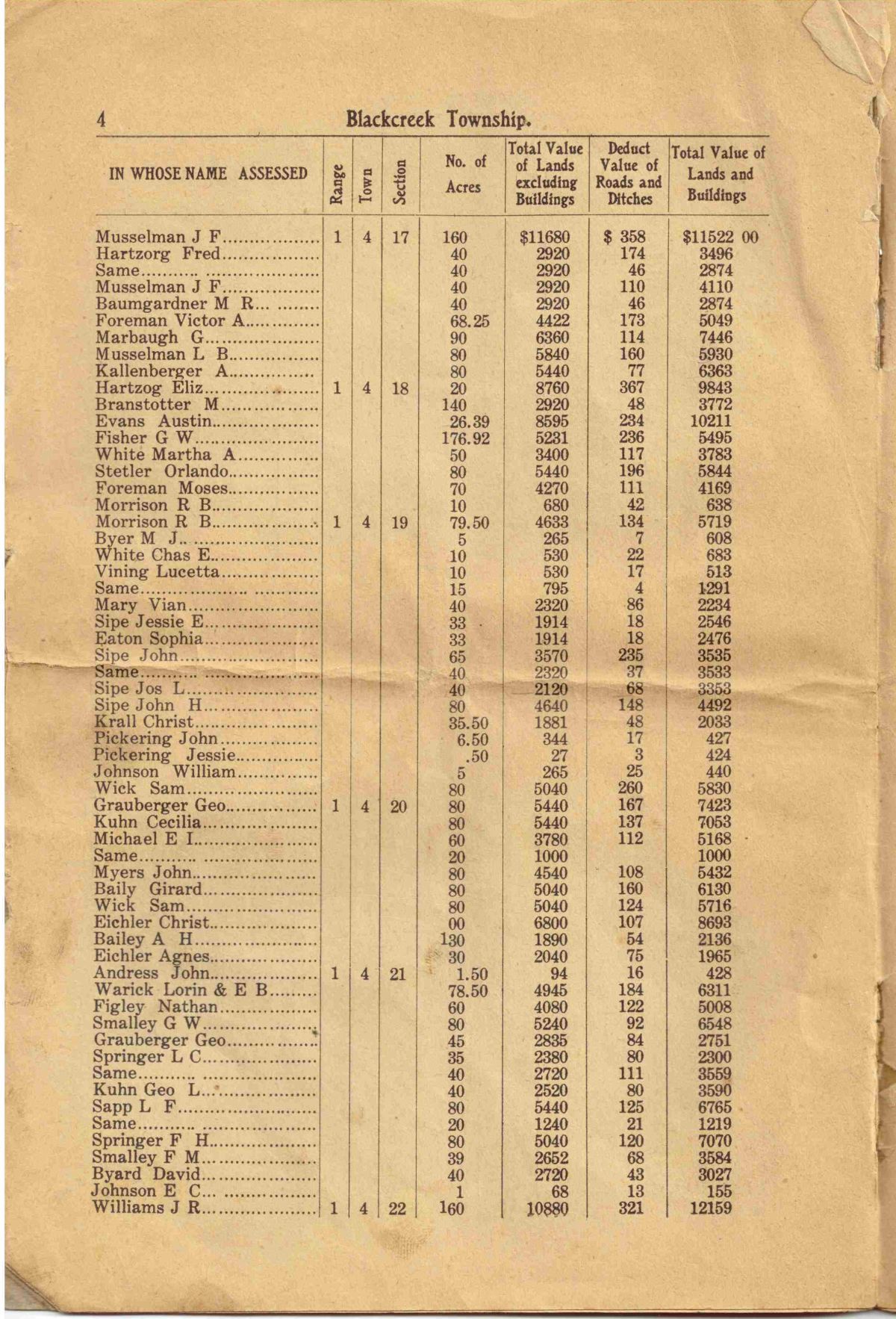
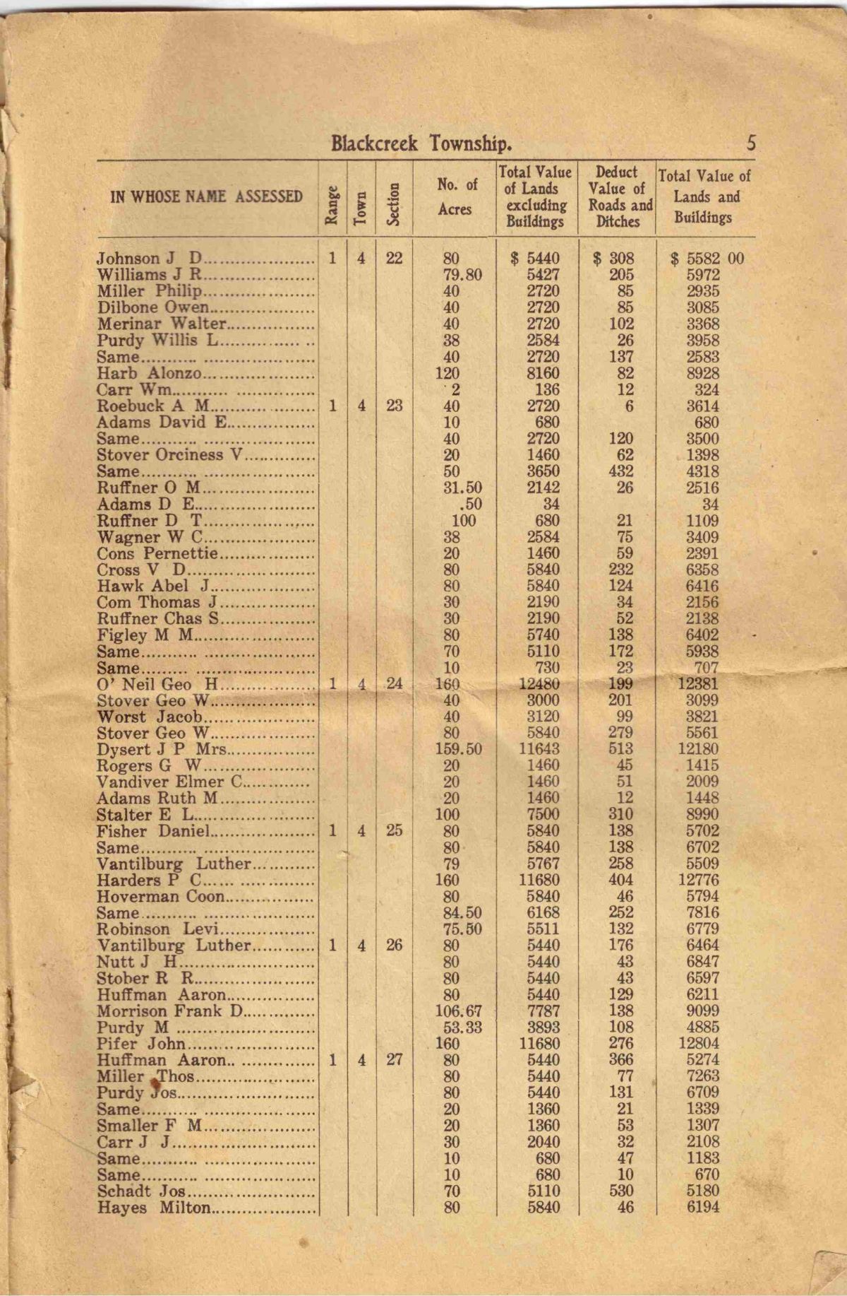
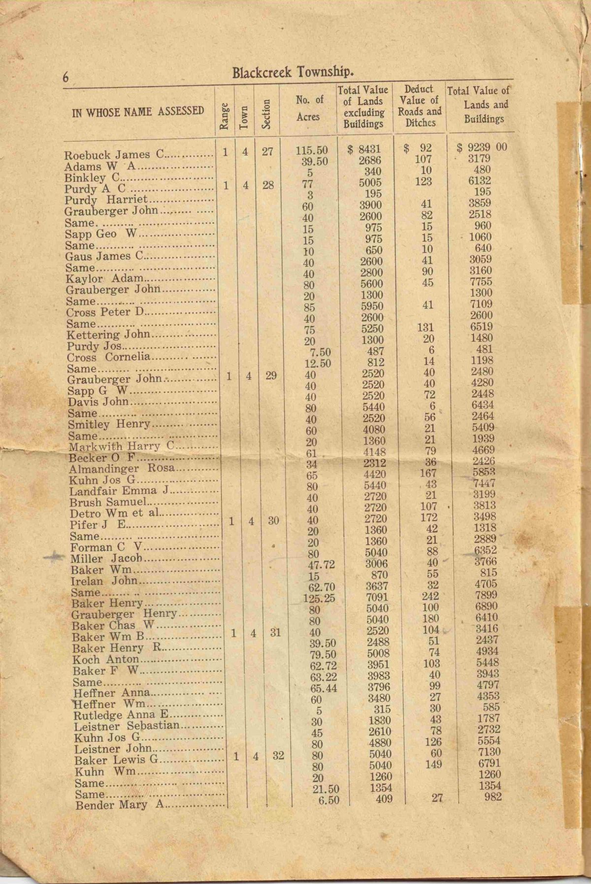
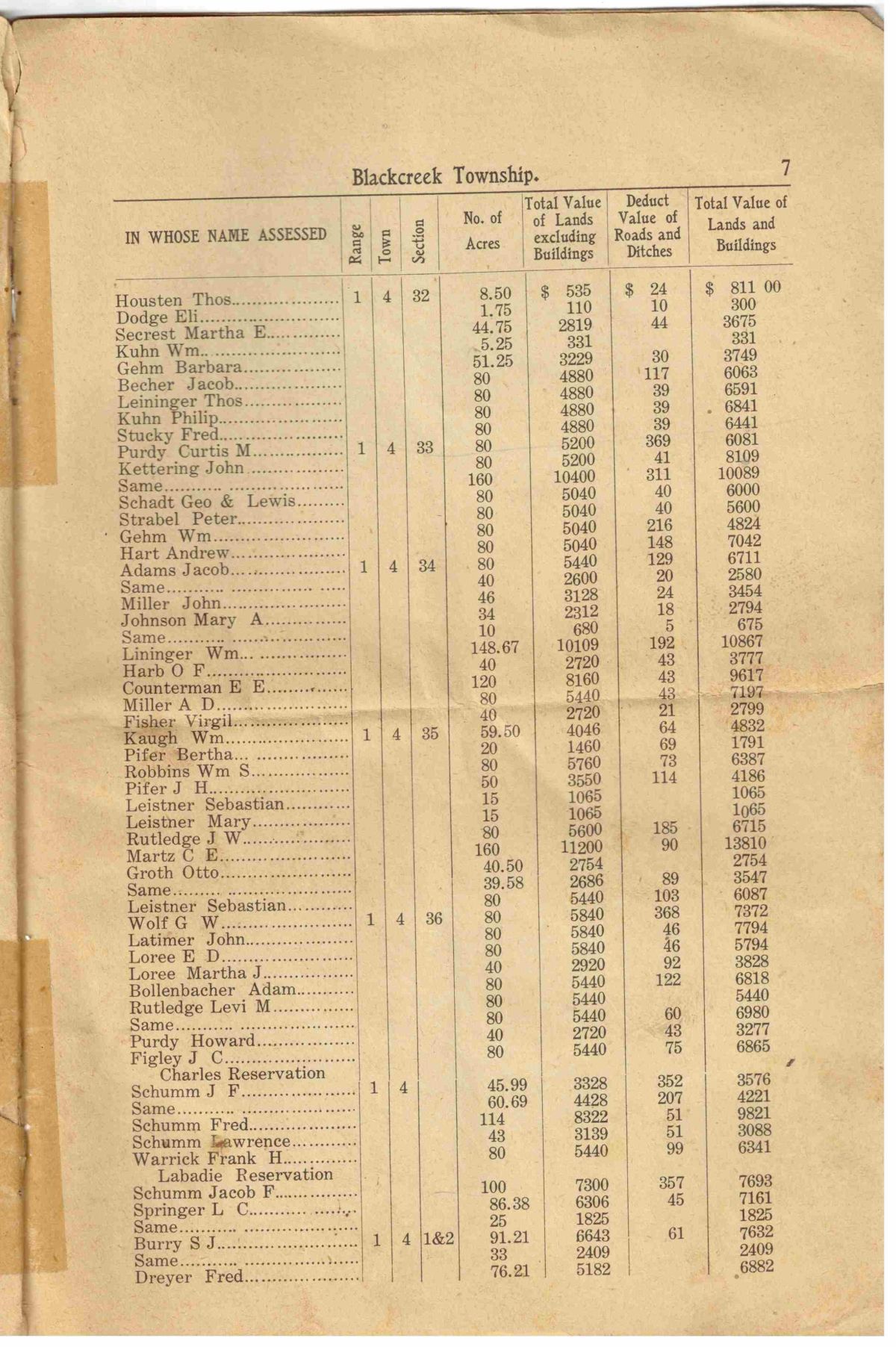
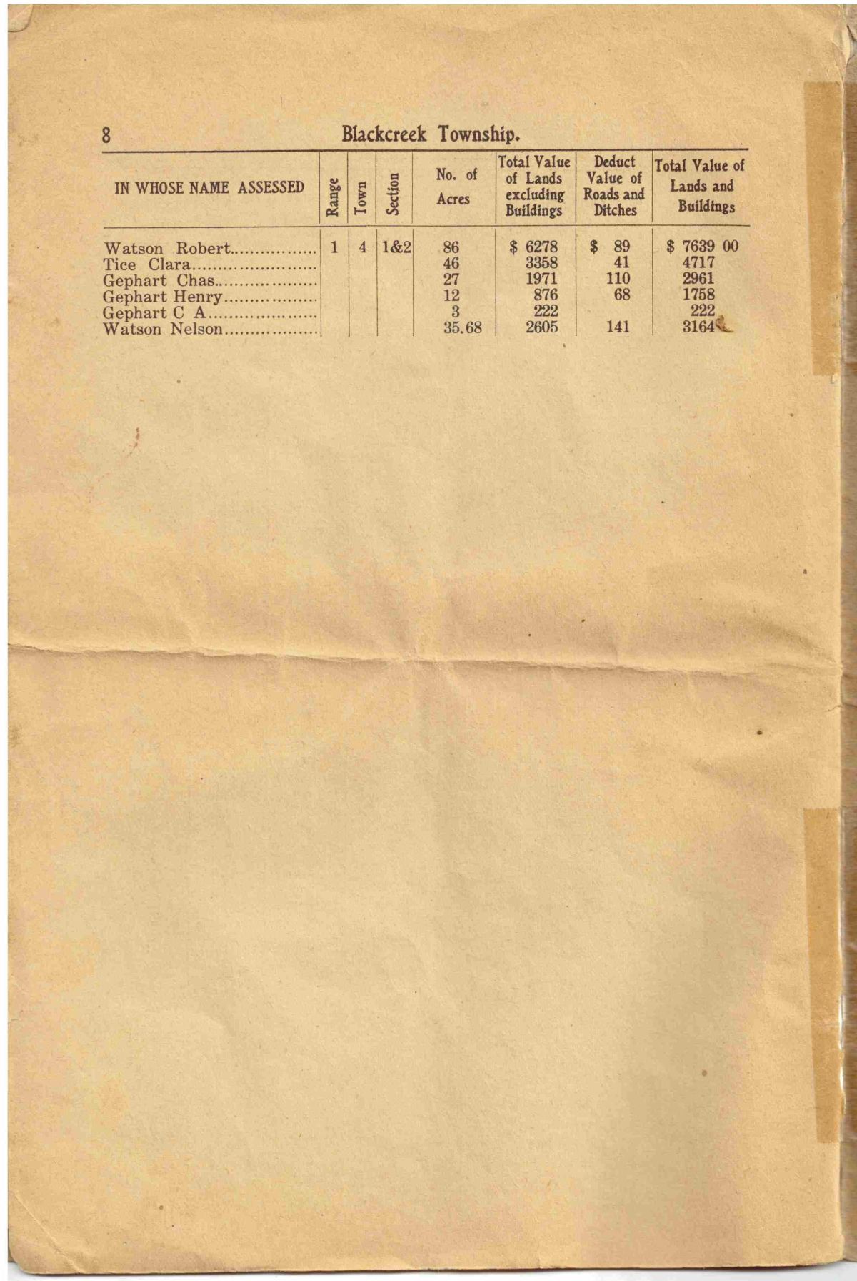
Last week I posted images of pages from the 1910 Quadrennial Assessor’s Report of Blackcreek Township. The booklet belonged to my great-grandfather Jacob Miller who owned an 80 acre farm in Blackcreek Township.
During that time period Ohio was in the process of changing its tax laws, switching from a decennial appraisement of real property (every ten years) to a quadrennial appraisement (every four years). A general appraisement was made in 1910 and another appraisement was to be made in 1914. [1]

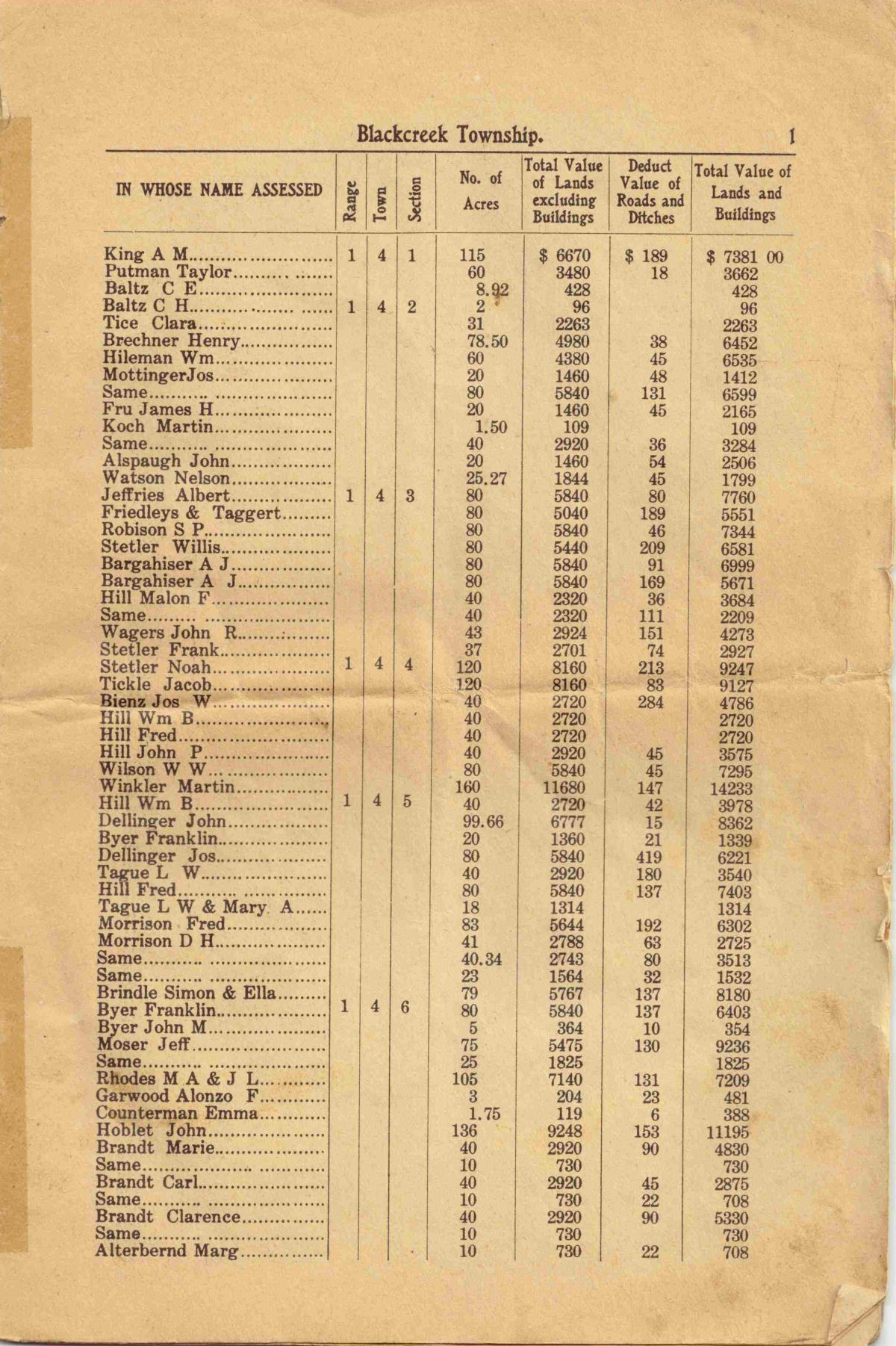
1910 Decennial Appraisement. Black Creek Township, Mercer County, Ohio.
Several years ago, while researching at the Mercer County Courthouse, I photographed some images from a much larger hard cover book, “Decennial Appraisement, 1910, Black Creek Township.” This book contains plat maps drawn of each of the township’s 36 sections. It includes the exact same information as the 1910 Quadrennial Assessor’s Report as well as some additional information about the assessment. [2]
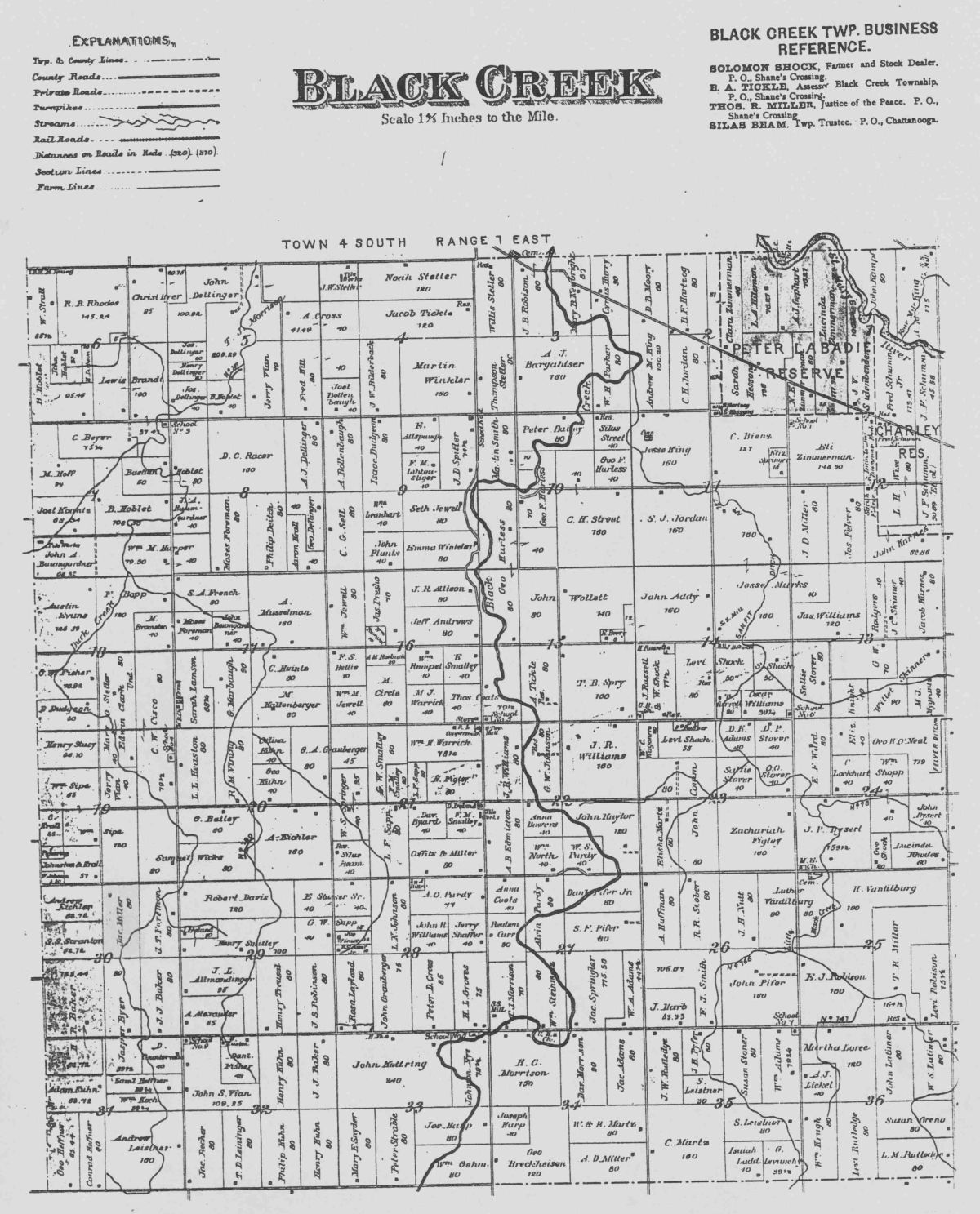
Blackcreek Township, Mercer County, Ohio.
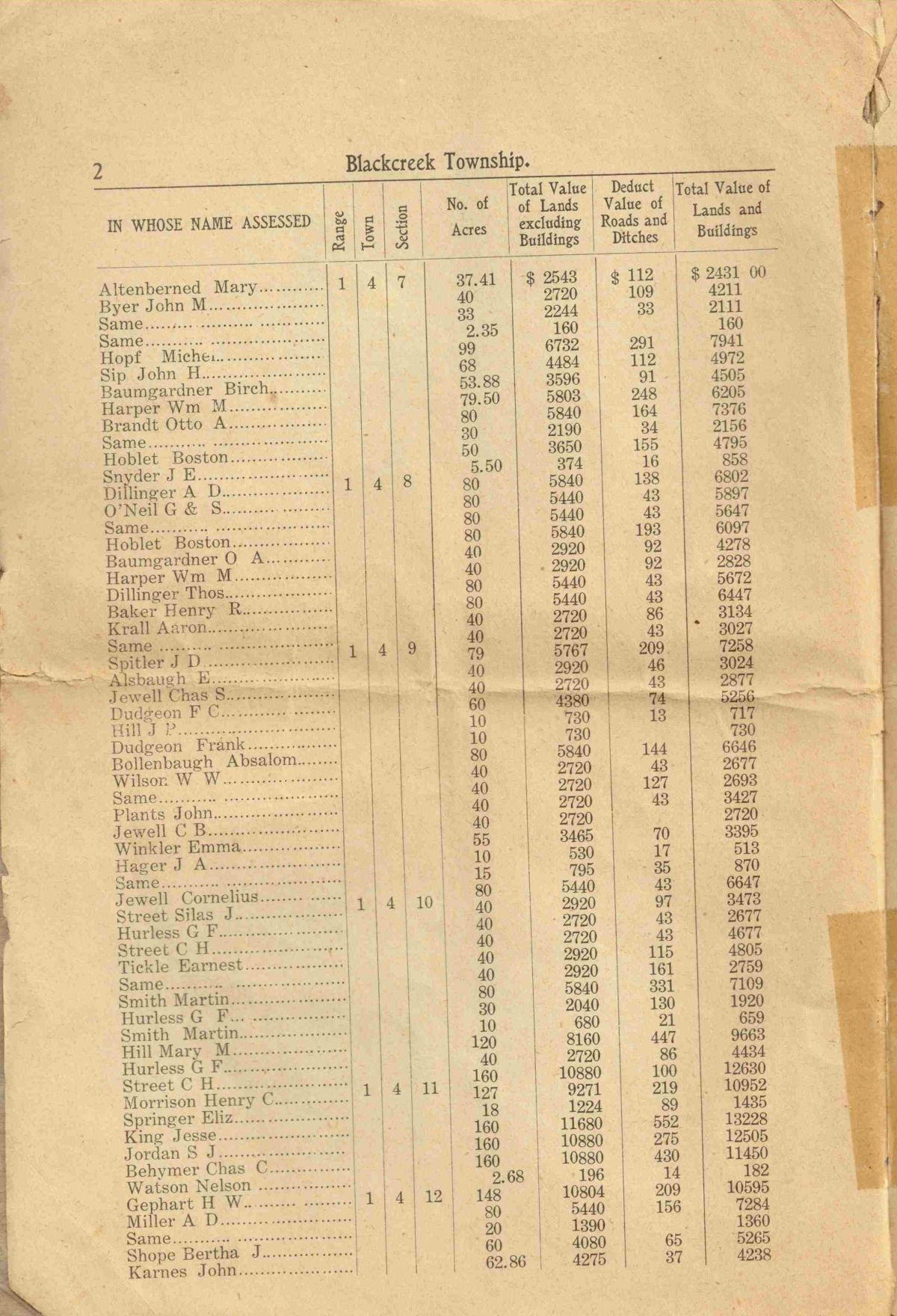
Additional information about the Jacob Miller farm, as recorded in the 1910 Decennial Appraisement:
• He had 63 plowable acres, 7 acres of meadow and pasture land, 10 acres uncultivated & woodland.
• His land was valued at $63 per acre, making a total value of $5040, excluding buildings.
• $88 was deducted for the value of roads
• The Miller home was valued at $800, the barns $500, and other buildings $100, for a total value for lands and buildings of $6352.
• The County Board of Equalization added $50 on land, $0 on buildings, for a total value of $6402, as equalized by the County Board.
• The State Board of Equalization added $1600.50, making a total value of $8002, as equalized by the State Board.
Below are four images from the 1910 Decennial Appraisement of Blackcreek Township, sections 29-32, north of Chatt on either side of Route 49. Sections 30 and 31 border Indiana and are west of State Route 49. Sections 31 and 32 border Liberty Township and are on the north edge of Chatt. Sections 29 and 32 are on the east side of State Route 49.

Section 29 Blackcreek Twp 1910
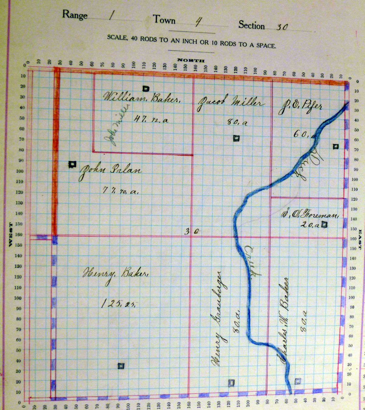
Section 30 Blackcreek Twp 1910
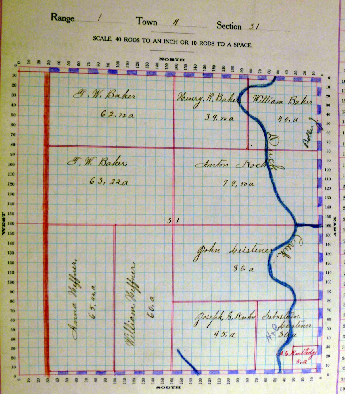
Section 31 Blackcreek Twp 1910
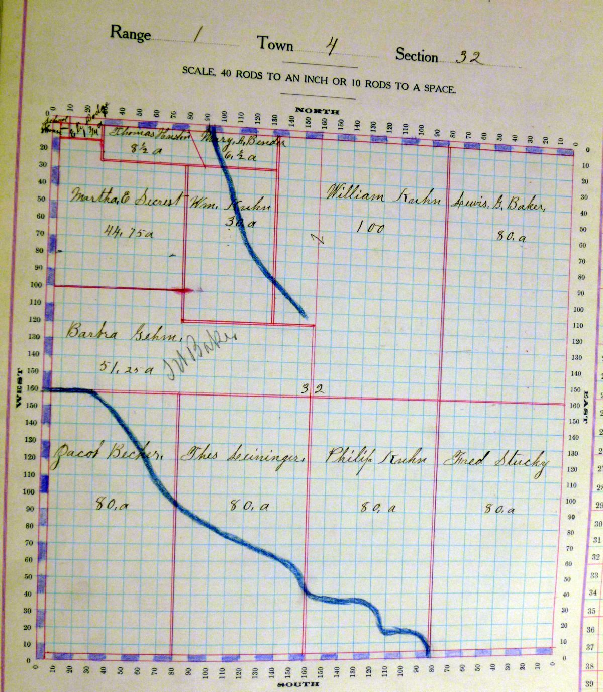
Section 32 Blackcreek Twp 1910
I plan to post all of the section maps on a static page on this website soon.
[1] “Taxation Work and Experience in Ohio,” The Ohio Journal of Commerce, Volume 2, No. 10, 3 September 1910, p.148; Google Books.com (https://books.google.com : accessed 19 March 2015).
[2] Additional columns in the Decennial Appraisement book include: PO address; description of property [legal]; no. of acres classified [broken down as arable and plow land, meadow & pasture land, uncultivated & wood land]; value per acre excluding buildings; deduct value of roads; value of all buildings [broken down as houses, barns, other building]; amount added or deducted by County Board of Equalization on lands; amount added or deducted by County Board of Equalization on buildings; total value as equalized by County Board; amount added or deducted by State Board of Equalization; total value as equalized by State board.