Fraud. Conspiracy. False pretense. Circulation of erroneous statements. Issuance of false financial statements. A swindle involving over one million dollars of stockholder’s money. What had Carrie gotten herself into?
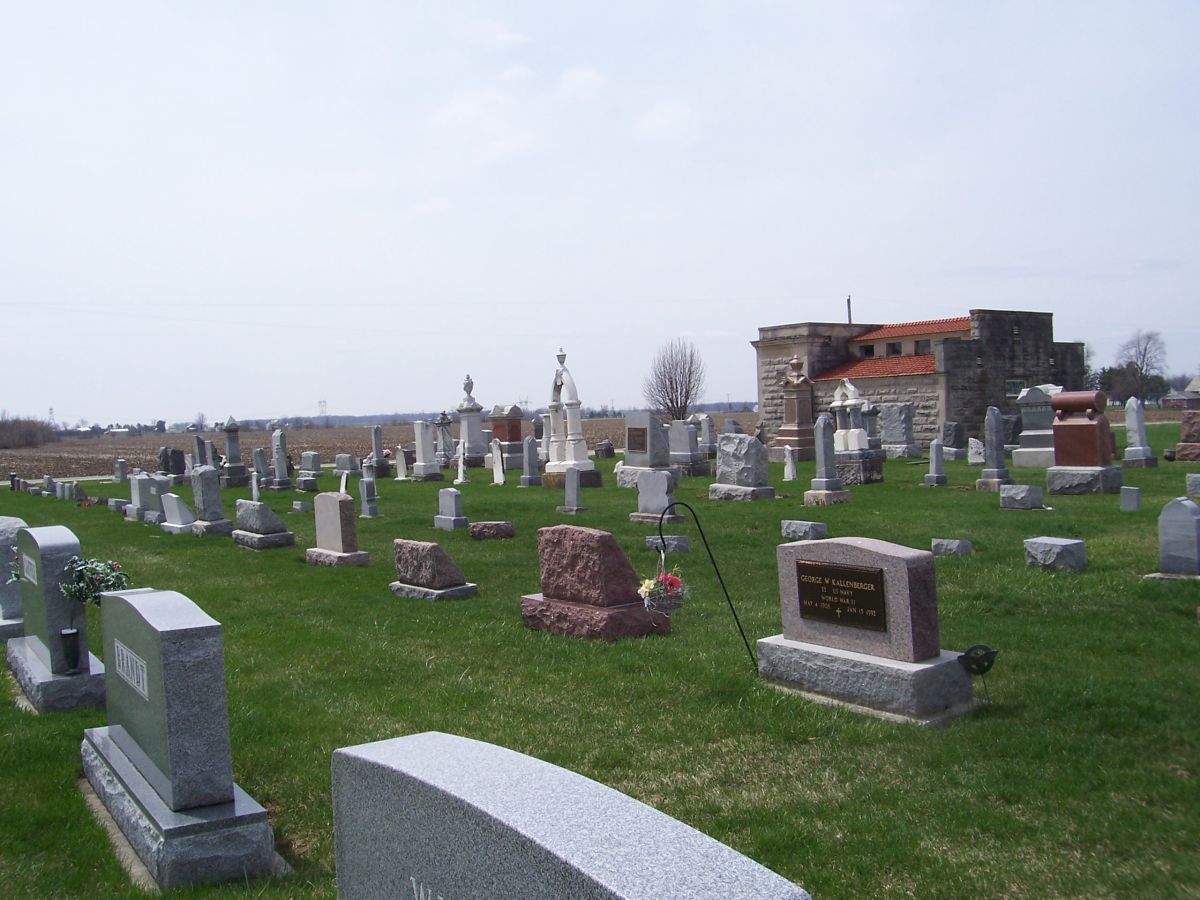
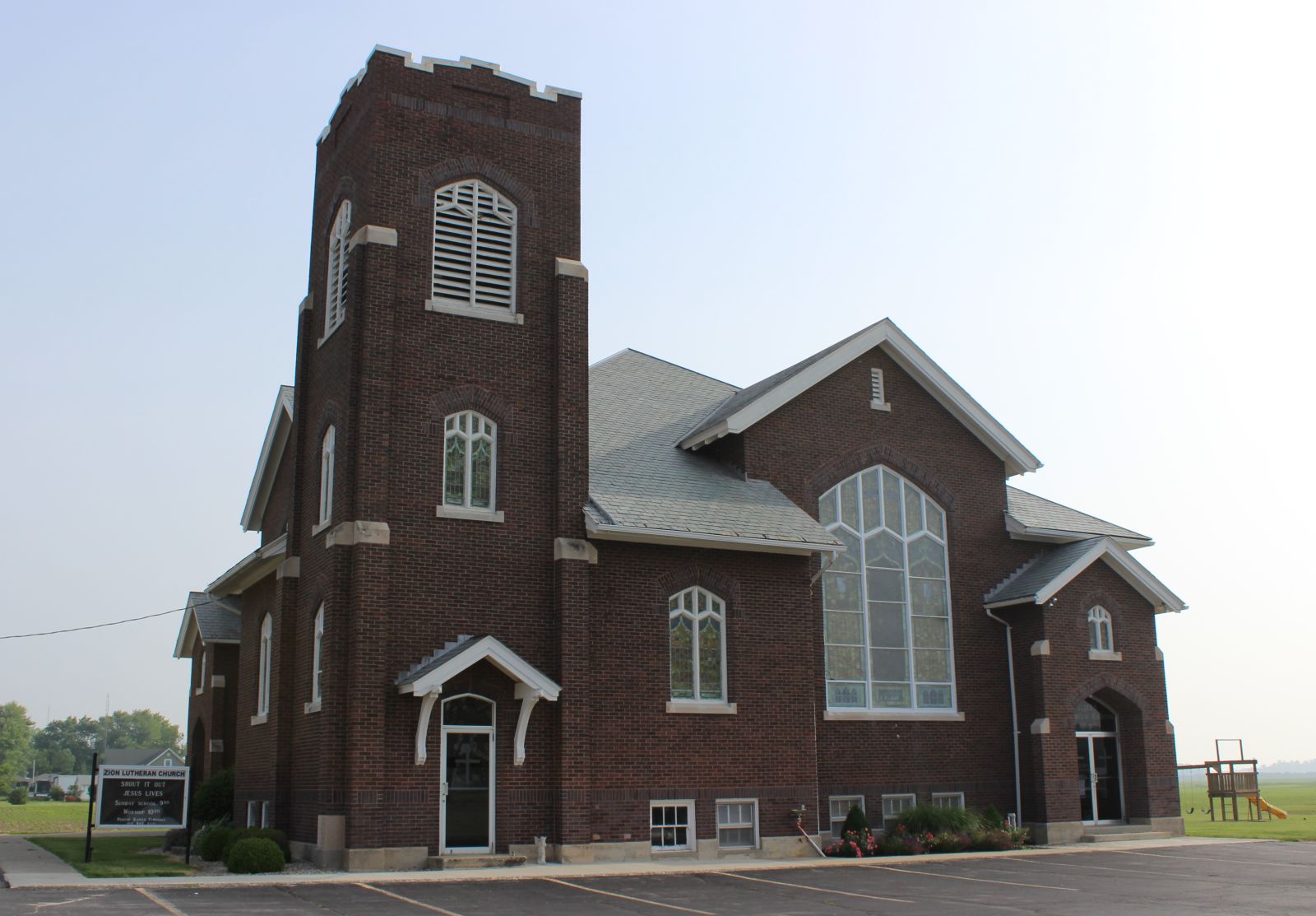
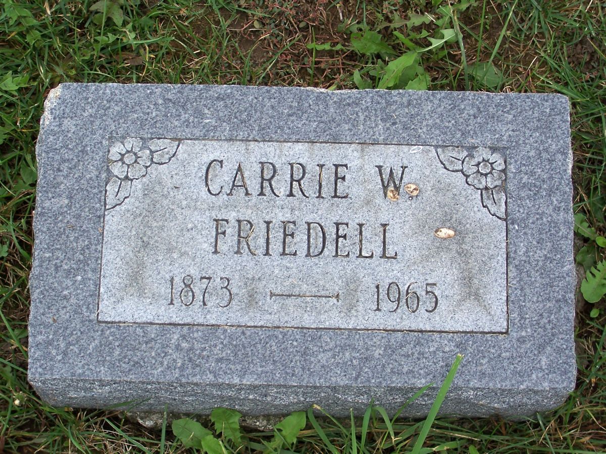
As a review, Carrie W. Friedell (1873-1965) is buried in Zion Lutheran Cemetery, Chattanooga, Ohio, but her burial is not recorded in Zion’s records. No mention of her whatsoever. Who was Carrie W. Friedell and what is her connection to Zion Chatt? I wanted to know. Through research I learned she was born in Delaware County, Indiana, to Benjamin F. and Harriett E. (Bobo) Edgington. She married Edwin H. Eichhorn in 1893 and they divorced in 1911. [1] Carrie’s story and my quest to learn her connection to Zion Chatt continues:
After Carrie’s divorce from Edwin H. Eichhorn in 1911 she lived near Marion, Indiana, and newspaper accounts told that she visited her parents in Huntington from time to time.
Then Carrie met Max Friddle.
Max Welton Friddle was born about 1874 in Indiana, the son of Robert M. (1835-1907) and Adelaide (Robinson) Friddle (1844-1883). [2]
Max W. Friddle married Nina Pearl (Helm) Guthrie 31 December 1899 in Delaware, Indiana. [3] Nina Pearl was also known as Pearl, Pearl N., or Nina Pearly.
In 1900 Max and Pearl lived in Liberty, Delaware County, Indiana, where Max farmed. Pearl had been married before and had two children from her first marriage. Max and Pearl had a son of their own, Frank Friddle, born about 1901. [4]
By 1910 Pearl Friddle, age 32, was a servant in the Dr. William Kemper household on East Main Street in Muncie. Pearl and Max’s son Frank Friddle, age 9, was in the household with her. Pearl indicated she was married but I do not know where Max was living. He was not in that household. [5]
In 1920 Pearl Friddle stated that she was a widow. She was a servant in the Martha J. Johnson household on Washington Street, Muncie. Martha’ son-in-law Karl A Oesterle was the vice president of a bank. Pearl’s son Frank Friddle, 19, was also in the household, enumerated as a lodger. [6] In fact, in 1931 and 1938 Pearl still indicated she was the widow of Max W. Friddle. [7]
Just where was Pearl’s husband Max Friddle in 1920? He was not dead. No. He was married to Carrie W. Edgington Eichhorn, and probably living in or near Marion, Indiana.
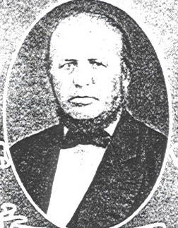
Max W. Friddle was calling himself Max W. Friedell by 1920. He changed the spelling of his name from Friddle to Friedell sometime after his marriage to Carrie in 1919. I will use both spellings in this post, depending on the time period of the information I am using. Just know that Max Friddle and Max Friedell are the same person. One and the same. In addition, some newspaper accounts give his name as Morton W. Friedell.
Max Friedell. Oil tycoon. The soon-to-be organizer, promoter, and president of the Black Panther Oil & Refining Company.
It probably all started with the oil boom in central Indiana during the winter of 1918-19, the first boom since around the turn of the century. There was money in oil. Indiana oil was selling at $2.28/barrel, making even the small wells profitable.
There was the Albany Oil Field, about eight miles northeast of Muncie; the Pennville Field in Jay County; and the Jalapa Oil field west of Decatur. Reports said that oil companies were leasing and drilling so many wells on area farms that the “donkey engines” could not keep up. Pumps were reportedly pulling to capacity twenty-four hours a day but could not get all the production from the wells. In addition, supplies and men were scarce and companies would drill as soon as the materials could be obtained from Toledo or Lima, Ohio, or Robinson, Illinois. [8]
The time was right. No doubt about it, money could be made from this oil boom. People were willing to invest in oil speculation and others were more than willing to take their money.
Enter Max Friedell. He was from the area. He knew the Indiana oil fields because he had worked in them. It was a wholesome rural farm community. He knew what it would take to sell his idea to the people back east and to others in the area.
This newspaper account indicates that Carrie and Max wed in Indiana:
Warren, Ind., April 1—At the home of the bride’s parents, Dr. and Mrs. B.F. Edgington, Saturday evening, was solemnized the wedding of Mrs. Carrie Eichorn and M.W. Friddle. Mr. Friddle is interested in the oil business. The happy couple left for Pennsylvania on their wedding trip. [9] Saying he was interested in the oil business was an understatement.
Another record indicates Max and Carrie were married in Philadelphia in 1919. [10]
It was a new beginning for both in more ways than one. This was when Max changed the spelling of his name from Friddle to Friedell. He left Indiana as a Friddle and became a Friedell while in Pennsylvania. And, while they were honeymooning in Philadelphia, Max undoubtedly organized The Black Panther Oil and Refining Company.
After their marriage Max and Carrie came back to Indiana and set up housekeeping. They were living in Marion by January of 1920. [11] I have not been able to locate the couple in the 1920 census, however.
Max Friedell started The Black Panther Oil & Refining Company in 1919. Max was the organizer, promoter, and president of the company. His friend Harry E. Lindley was the vice president and sales manager. Carrie was the company’s secretary. The company had oil holdings in Indiana and Montana and was capitalized at $10 million.
Max had no trouble getting investors and the money started to roll in. He convinced investors they were investing in a sure thing. Max and Carrie were living large. That is, until April 1922, when the whole thing started to collapse around them. Stockholders discovered a shortage in the company’s funds. About 800 Black Panther Company Stockholders, many of them women, met in Philadelphia on 11 April 1922 and voted officers Max, Harry, and Carrie out and elected new officers and a new Board of Directors. [12]
One of the best articles I read about the whole story came out of Portland, Indiana, and was printed in The Indianapolis News in December 1922. Below are excerpts of that article:

Diamonds and Free Spending, But They Helped Sell Stock
M.W. Friedell and his Black Panther Oil Company Sort of Modern Aladdin and His Lamp
Shareholders Fight to Recover, but Looks as if All Were Gone.
Portland, Ind, December 2 (1922)—…M.W. Friedell, now under heavy bond in Philadelphia, charged with conspiracy and other offenses…two big diamonds, one valued at $15,000, and another at $5,000…the Black Panther Oil and Refining Company that had its main office at 1916-18 Race Street, Philadelphia, and its field office in the city of Portland…now in the hands of three receivers, one in Pennsylvania, another in Delaware, and Todd Whipple, of the law form of Whipple & Whipple, of this city…
The company’s last financial statement said that over $1,900,000 in stock had been issued but the receivers found that about $3.5 million worth of stock was sold to persons all over the U.S., the most sold in Philadelphia and New York. Very little was sold in Jay County, but a considerable amount was sold in the Marion, Indiana, area.
…The Black Panther Company owned the Independent Oil and Gas Syndicate of Marion, which had service stations either in reality or on paper at Anderson, Elwood, Pendleton, Muncie, Montpelier, Huntington, Marion, Kokomo, Alexandria, Noblesville, Newcastle, Hartford City, Bluffton, Wabash, Swayzee, and Middletown. It also owned the Service Refining Company at Kokomo and at Fairmount. Also among its possessions were the Jardine gold mine at Butte, Mont.; the Oil and Metals Corporation, of Philadelphia, and it had small properties in Warren County, Kentucky, and in Auglaize County, Ohio. It claimed to have large real estate holdings in New York, Pennsylvania, and Arkansas. The courts of half a dozen states are cluttered up with law suits resulting from efforts of a number of creditors to recover something from the wreck…
Some New York stockholders invested as much as $50,000 and many $10,000 blocks of stock were sold. Many investors were women. Widows who invested most, if not all, of their life savings or estates inherited from their husbands.
Before starting the company Max had lived around Warren, Huntington County, working in the oil fields and speculating in oil leases. Initially Max wanted to use $800 of Carrie’s money to invest in the oil business but she would not give him the money. Instead he got $1,000 from two friends and started the Black Panther Oil and Refining Corporation. The company was first incorporated for $350,000 and later for $10 million, under the laws of Delaware.
After the incorporation Friedell hired local taxi driver Bill Kavanaugh to drive him around the Indiana oil fields to get leases. Friedell was unable to pay the $135 taxi bill but promised Kavanaugh that he would be worth $1 million in less than a year and the bill would be paid many times over. The taxi bill was soon paid as the sale of stock went forward rapidly and Friedell returned to Portland with $190,000 in his suitcase.
Friedell purchased 1500 acres of leases in Jay County for about $2600 and paid the balance in stock in the company. He leased the 365 acre Henry Farm about seven miles northwest of Marion and he bought adjacent land to bring his holdings to over 400 acres. The farm was valued at over $400,000 in the company’s July 1921 financial statement but foreclosure suits placed the value at only $50,000.
They drilled 42 oil wells on the Henry Farm. Their prospectus and letters indicated that the wells were producing 2,000 barrels a day but in reality they were only producing 20 barrels a day at their peak. None of the oil produced on this farm was sold but was instead used as fuel to keep the oil drills and machinery going.
…The Henry Farm was advertised extensively as the Black Panther Stock Farm and on it were fancy cattle, hogs and sheep and close by were the wells from which oil was supposed to be flowing. On some of the land near the Henry Farm three oil tanks with a capacity of 800 barrels were erected. These were outfitted with a donkey engine that operated a pump and the oil was pumped out of the bottom of the tanks and emptied back into the tanks at the top. The purpose of this was to show persons brought here on excursions that the Black Panther field was producing a large amount of oil. Legal proceedings showed that no oil had been sold from the Black Panther field until in January of this year, and that the total amount sold up to the present time would amount to about $15,000…
Part of the plan to sell stock included new technology: “moving pictures.” They brought in actors from Boston and filmed them on the farm doing farm work and tending the livestock, all to show a realistic picture of rural life on a farm with producing oil wells.
…There were pictures of flowing wells and five reels were devoted to a display of wells that were being “shot” with great quantities of oil…
The “flowing” oil was actually oil taken from other wells and put there for filming purposes. The film reels were shown in New York, Philadelphia, and other eastern cities, and every showing was accompanied by a large sale of stock in their corporation. …Oil was taken in bottles and jugs to points in the east and used as bait for the selling of stock… [13]
Friedell even used John D. Rockefeller’s name to induce the sale of his stock. “Mr. Rockefeller is a good friend of the boys and always wants us to succeed.” [14]
The Fort Wayne Journal-Gazette, 20 August 1923
Max Friedell was living quite well off the sale of his oil stock. Friedell appeared in Marion wearing a diamond pin that he said cost $15,000 and a ring worth $5,000, both he said were given to him by an appreciative stockholder. He rode around Marion in a large sedan valued at $2,000 which he then gave to a taxi driver as a gift from the company. But it wasn’t long until the car was in receivership. He gave a $165 tip to his barber, a $50 tip to a waitress who served him breakfast, and gave a $1000 bill to a friend. He bought $800 worth of clothing and shoes for the poor in Marion, as a gift from his company. Remember–these were 1920-21 prices.
This article called him a “prodigal spender,” thinking no more of paying $1000 for a suit of clothes or to satisfy some little whim than the ordinary man would think of spending 50 cents…
Friedell purchased a home in Marion, paying $27,000 in $1 bills and put the home in Carrie’s name. He had a suite of 40 rooms in the Pennsylvania Hotel in New York, where he entertained visitors from the west. He purchased the company’s office building on Race Street in Philadelphia, completed its construction, and furnished it in mahogany. He entertained prospective stockholders in the building’s huge banquet hall and hosted a dinner said to have cost $10,000. Prospective investors got to see those moving pictures taken at the Henry Farm in Indiana and lot of stock was sold. Later there was found to be 5 mortgages against the Race Street building.
A Philadelphia grand jury charged that Friedell embezzled about $100,000. [13] That was probably the $100,000 income he allegedly received from the fraudulent conversion of more than $1,250,000 of stock-holders’ funds.
Max Friedell claimed he was innocent when he was arrested in Los Angeles on 3 October 1922. “I am not guilty and I can prove it.” [15] He was taken back to Philadelphia and first held under $7500 bond, which was later increased to a $40,000 bond. [16]
Todd Whipple, the Indiana receiver from Portland, said that practically nothing would remain for the stockholders after all was said and done. [13]
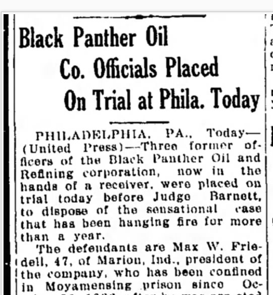
The trial began 21 August 1923 in Philadelphia. The defendants were charged with three indictments of conspiracy, two with false pretenses, and another with making and circulating a false statement of the company’s financial condition. Charges alleged they fraudulently obtained nearly $1,300,000 from 4,000 stockholders. [17]

Lebanon Daily News, 21 August 1923
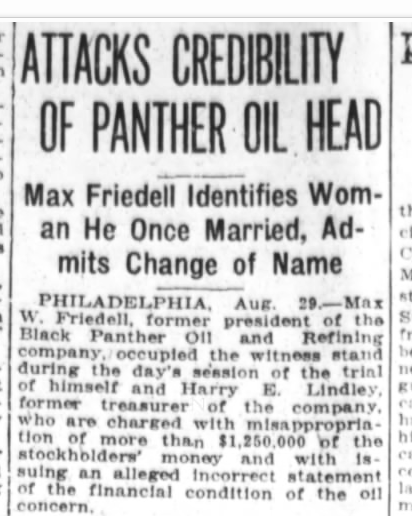
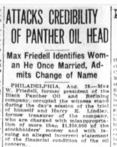
During the trial proceedings Max admitted that he changed his name from Friddle to Friedell. When asked about having two wives Friedell admitted that he had married Nina Pearl in 1900 but thought she had divorced him, which made prosecutors wonder if they should charge him with bigamy as well. [18] As if all this weren’t bad enough, he failed to recognize his own son Frank in court. [19]
Arguments for a motion for a new trial had to be postponed because stenographers were unable to complete the transcription of the 2,400 pages of testimony taken at the trial. [20]
Friedell and Lindley were convicted in August 1923 on charges of conspiracy, false pretense, and issuing a false financial statement of the company’s condition. On 18 January 1924 Max Friedell was sentenced to eight years in the county prison and Harry K. Lindley to three years in the county jail. Another company officer was also convicted. [21]
I found it interesting to read that in 1926, Max Friedells’s former oil partner Harry Lindley tried to get some of the former Black Panther stockholders to put up $40,000 to free Friedell from jail. After former stockholders unanimously refused to do that Lindley tried to get them to put up $2000 for Friedell’s legal expenses. Lindley tried to convince them that Friedell had a new venture in mind and that stockholders would receive stock in the new enterprise and their money would be restored. Lindley assured them there were only five chances in a hundred of the new, top-secret scheme failing. The new enterprise would be launched as soon as Friedell was released from prison. [22] I am not sure if any of the former stockholders bought into that or not but the Black Panther Oil Company did continue on in some form into at least the 1940s. [23]
At least two other newspaper accounts mention Max Friedell’s two wives. Want Title Quieted to Black Panther Oil Land, where the women were defendants, along with Max, in a suit filed in Grant Circuit Court to quiet the title to the Jalapa Oil field west of Decatur, Indiana. [24]
The other newspaper article involves oriental rugs:
One of Friedell’s “Wives” Sued for Oriental Rugs
Marion, Ind, Sept, 20—Claiming they were purchased out of the funds of the Black Panther Oil Company and that they have a value of $5,000, suit to replevin twenty imported oriental rugs of assorted sizes and styles, has been filed in the local Circuit court by Lewis W. Edmundson, Ted Whipple, and Edward W. Cooch, receivers for the Black Panther company, against Carrie W. Friedell.
She is one of the alleged wives of Max W. Friedell, organizer and former president of the company, who was recently convicted of fraud in connection with the sale of oil stock by a Philadelphia court. The receivers charge the rugs are at the home of the defendant in this city, and that they are being unlawfully detained. Possession is sought. Two women claim they were married to Friedell. [25]
I do not know what happened to Max W. Friedell, aka Max W. Friddle after that. I have not been able to find his name in the 1930 or 1940 census nor in any other on-line search during that time period. Perhaps he was using another alias. Find a Grave.com has a Max W. Friddle, born 16 Feb 1874, died 1944, buried in Fairview Cemetery, Randolph County, Indiana. Engraved on the tombstone with his name is Naomi A. Friddle (1896-1899). [26] I do not know if this is the same Max Friddle/Friedell.
Again, all of this is very interesting stuff, but none of these people who Carrie associated with seem to have a connection to Zion Chatt. None of this information gives me the answer to my initial question: What is Carrie W. Friedell’s connection to Zion Lutheran Church in Chatt?
To be continued next Friday, in the final installment of Zion Chatt’s Mid-Summer Mystery Series, when I have my Ah-ha Moment.
[1] See blog posts Tombstone Tuesday—Carrie W. Friedell, 25 August 2015; Zion Chatt’s Mid-Summer Mystery, Part 1, 29 August 2015; Zion Chatt’s Mid-Summer Mystery, Part 2, 4 September 2015; Karen’s Chatt, www.karenmillerbennett.com.
[2] 1880 U.S. Census, Greene, Randolph, Indiana, ED 163, p.69C, dwelling 180, family 189, Robert Friddle; digital image by subscription, Ancestry.com (www. ancestry.com : accessed 5 Sep 2015); from NARA microfilm T9, roll 306.
[3] Indiana, Select Marriages, 1780-1992, database on-line, Ancestry.com (www.ancestry.com : accessed 5 Sep 2015); original data from FamilySearch.
[4] 1900 U.S. Census, Liberty, Delaware, Indiana, ED 46, dwelling 235, family 239, p.11A, Max W Friddle; digital image by subscription, Ancestry.com (www.ancestry.com : accessed 5 Sep 2015); from FHL microfilm 1240368, from NARA microfilm T623, roll 368.
[5] 1910 U.S. Census, Muncie Ward 3, Delaware, Indiana, ED 31, dwelling 133, family 148, William Kemper; digital image by subscription, Ancestry.com (www.ancestry.com : accessed 5 Sep 2015); from FHL microfilm 1374359, from NARA microfilm T624, roll 346.
[6] 1920 U.S. Census, Muncie Ward 3, Delaware, Indiana, ED 31, p.1A, house 322, dwelling 4, Martha J Johnson; digital image by subscription, Ancestry.com (www.anncestry.com : accessed 5 Sep 2015); from NARA microfilm T625, roll 426.
[7] U.S. City Directories, 1822-1989, database on-line, Ancestry.com (www.ancestry.com : accessed 5 Sep 2015); from Muncie, Indiana, City Directory, 1931, p.252, and Muncie, Indiana, City Directory, 1938, p.122.
[8] “Supplies and Men Scarce; New Oil Boom Retarded,” The Indianapolis News, Indianapolis, Indiana, 13 Mar 1919, p.13; digital image by subscription, Newspapers.com (www.newspapers.com : accessed 28 Aug 2015).
[9] “Marriages, Warren, Ind.,” The Fort Wayne Sentinel, Fort Wayne, Indiana, 1 Apr 1919, p.13; digital image by subscription, Newspapers.com (www.newspapers.com : accessed 28 Aug 2015).
[10] Philadelphia, Pennsylvania, Marriage Index, 1885-1951, Philadelphia County Pennsylvania Clerk of Orphans’ Court, “ Pennsylvania, Philadelphia marriage license index, 1885-1951,” Clerk of the Orphans’ Court, Philadelphia, Pennsylvania; database on-line, Ancestry.com (www.ancestry.com : accessed 14 Aug 2015); digital GSU no. 4141695 [Max W. Friedell married Carrie W. Eichhorn, in Philadelphia, Pennsylvania, in 1919.]
[11] “Warren,” The Huntington Press, Huntington, Indiana, 31 Jan 1920, p.7; digital image by subscription, Newspapers.com (www.newspapers.com : accessed 28 Aug 2015).
[12] “Oil Officers Voted Out,” The New York Times, New York, New York, 12 Apr 1922, p.21; digital image by subscription, Newspapers.com (www.newspapers.com : accessed 28 Aug 2015).
[13] “Diamonds and Free Spending, But They Helped Sell Stock,” The Indianapolis News, Indianapolis, Indiana, 2 Dec 1922, p.16; digital image by subscription, Newspapers.com (www.newspapers.com : accessed 28 Aug 2015).
[14] “Name of Rockefeller Used in Stock Sale,” The Indianapolis News, Indianapolis, Indiana, 11 Nov 1922, p.1; digital image by subscription, Newspapers.com (www.newspapers.com : accessed 18 Aug 2015).
[15] “Oil Promoter Says He is Innocent of Big Theft,” Modesto Evening News, Modesto, California, 3 October 1922, p.13; digital image by subscription, Newspapers.com (www.newspapers.com : accessed 28 Aug 2015).
[16] “Black Panther Chief Held Under $40,000,” Harrisburg Telegraph, Harrisburg, Pennsylvania, 23 December 1922, p.1; digital image by subscription, Newspapers.com (www.newspapers.com : accessed 18 Aug 2015).
[17] “Black Panther Oil Co. Officials Placed On Trial at Phila. Today,” Lebanon Daily News, Lebanon, Pennsylvania, 21 Aug 1923, p.22; digital image by subscription, Newspapers.com (www.newspapers.com : accessed 28 Aug 2015).
[18] “Attacks Credibility of Panther Oil Head; Max Friedell Identifies Woman He Once Married, Admits Change of Name,” The Fort Wayne Journal-Gazette, Fort Wayne, Indiana, 30 Aug 1923, p.3; Newspapers.com (www.newspapers.com : accessed 28 Aug 2015).
[19] “Fails to Recognize His Son,” The Evening News, Harrisburg, Pennsylvania, 29 Aug 1923, p.1; Newspapers.com (www.newspapers.com : accessed 18 Aug 2015).
[20] “Motion for New Trial Postponed by Court,” Harrisburg Telegraph, Harrisburg, Pennsylvania, 5 Oct. 1923, p. 17; Newspapers.com (www.newspapers.com : accessed 27 Aug 2015).
[21] “Black Panther Oil Men Sentenced,” The Wilkes-Barre Record, Wilkes-Barre, Pennsylvania, 19 Jan 1924, p.20; Newspapers.com (www.newspapers.com : accessed 18 Aug 2015).
[22] “Those Duped in the Black Panther Fiasco Now Asked to Pay to Free President,” The Evening News, Harrisburg, Pennsylvania, 7 Aug 1926, p.6; Newspapers.com (www.newspapers.com : accessed 18 Aug 2015).
[23] “Black Panther Oil Head Shot and Killed Partner 1941,” The Pittsburgh Currier, Pittsburgh, Pennsylvania, 29 Nov, 1941, p.18; Newspapers.com (www.newspapers.com : accessed 18 Aug 2015).
[24] “Seeks to Quiet Title,” The Indianapolis News, Indianapolis, Indiana, 15 Sep 1923, Newspapers.com (www.newspapers.com : accessed 28 Aug 2015).
[25] “One of Friedell’s “Wives” Sued for Oriental Rugs,” The Indianapolis Star, Indianapolis, Indiana, 21 September 1923, p.10; Ancestry.com (www.ancestry.com : accessed 14 Aug 2015).
[26] Find a Grave.com (www.findagrave.com : accessed 8 Sep 2015); Max W. Friddle, memorial #62330387.